
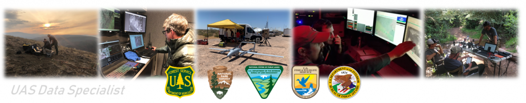
Resources for UAS Data Specialists on incidents. This page is continually updated as new information becomes available.
Prospective UASDs!
UASD can be an entry point into wildland fire support. If you have never been to a fire before, please work with your local fire specialists to acquire the necessary training, gear, and knowledge to setup for success before you make yourself available as a trainee.
All UASD trainees must have appropriate hardware and software ready upon arrival at an assignment. For the 2024 season, this includes:
- Laptop with agency GIS specifications or ArcGIS Pro Specifications
- ArcGIS Pro version 3.2
- A NIFC ArcGIS Online account and completion of any required training, such as the Acceptable Use Policy Course
Recommended additional capabilities include:
- ESRI Imagery Analyst License
- WinSCP and a NAP account (NIFC FTP access)
- Access to photogrammetry software such as Metashape, Pix4D, IDM
- VLC or other software for converting and manipulating video.
Skills required for success are varied depending on the assignment. At a minimum trainees must be familiar with:
- Efficient use of ESRI ArcGIS Pro
- Creating, editing, and managing data in a geodatabase
- The GeoOps file structure and naming conventions
- The National Incident Feature Service
Note on UASD Self sufficiency: Depending on the situation, data specialists may or may not have access to fire camp amenities. UASDs should be prepared for self sufficiency on assignment, especially if supporting Type 3 or 4 UAS modules. Talk to the UASM or UASL before mobilizing to confirm expected arrangements for food and lodging. Keep in mind that UAS modules commonly move between fires, so the situation may change over the course of an assignment.
Planning
Guides
- UASD Mobilization Checklist
- Site Selection Workflow
- ArcGIS Pro Configuration for offline use
- UASD Performance Metrics - An example from Robertson Draw MT (RThurau, 7/14/2021)
Data Structures
- UAS Folder Template (2024 Version, Data Structure only)
- GeoOps Directory Structure and File Naming
- PMS 936-1 GISS Workflow
Data Sharing
- OneDrive for Fire Incident Data
- OneDrive for Geospatial Workflows (USFS Non Fire)
- Bush Fire 2020 Remote GISS Writeup
Data Sources
- USGS National Map
- Feature Layer Download for use with the National Basemap (MPanunto, 6/15/2021)
- USGS DEM Directory
- FAA Sectionals
- Fire EGP
- BLM Navigator
Operations
CWN Systems Overview
- Argentech AltiTransition Updated 6/14/2022
- Bridger Latitude
- Insitu Scan Eagle
- Precision Stalker
- Script for tiling Precision GCS maps (Ridley 2020)
Flight Planning
- CWN Mapping Flight Plan Construction
- Transect Planning (Slides)
- Principles of Aerial Photography for Fire Mapping (Slides)
- FLIR Duo Pro R User Guide
- Triangle Calculator (website)
Metashape and Photogrammetry
- IR Image Processing (RThurau Presentation 4/28/2021)
- FLIR Vue Pro R Metashape Single Page Guide (USGS)
- FLIR Vue Pro R 13mm Orthomosaic Full Workflow for Metashape (USGS)
- Agisoft Metashape User Guide v1.5
- Processing Fire Imagery (Slides)
- Manipulating Imagery with ArcGIS (Slides)
Tools
- UAS Pro Project Template (Zipfile, BSchroeder 2022)
- UASD LRZ Toolbox (Zipfile, BSchroeder 2022)
- UAS Flight Planning Spreadsheet (Object Distance Spreadsheet, Gapinski, 8/10/2024)
- UASD CWN Tasks (BSchroeder Workflows 2020)
- UASD Tools Zipfile (Fire ODS, CSV to GPX script, FLIR IR to Fahrenheit conversions, 2020)
- UASD Python Tools (RThurau scripts for Viewshed, Image Management, Mission Planner to KML/Shapefile)
Training and Reference
Incident Support Summaries
- 2020 - Mullen, WY (Bridger Latitude)
- 2020 - El Dorado, CA (Bridger Latitude)
- 2020 - Sawtooth/Bighorn, AZ (Bridger Latitude)
- 2019 - Corta Fire, NV (Bridger Latitude)
- 2019 - Roberts Fire, NM (Bridger Latitude)
- 2019 - Skid Fire, NM (Bye UAS Silent Falcon)
- 2018 - Taylor Creek/Klondike/Garner Complex (InSitu Scan Eagle)
Software and Hardware Reference
- Trillium Skylink Elevation Data Structure (6/2022)
- Avenza 4.0 Workflow - Airdrop and Export a Map (Updated 5/2022)
- FLIR Duo Pro R User Guide
- Introduction to Full Motion Video (ESRI)
- Agisoft Metashape User Guide v1.5
UASD Position Information
- UAS Data Specialist Position (NWCG)
- UASD Position Qualification Requirements (PMS 310-1)
- UAS Taskbook (PMS 311-79)
- UASD Position Overview
- The UASD Position (ESRI Storymap)
Links
- NWCG Standards for Fire Unmanned Aircraft Systems Operations
- NWCG GISS Workflow, PMS 936-1 - NWCG GISS Workflows
- USFS Fire Imaging Technologies for Wildland Fire Operations - Information about other ISR Platforms
- Motion Imagery Standards Board Website - Technical documents related to FMV
Sample Data